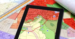
At TEMS Tech Solutions (TTS), our Land Use and Zoning Analysis service provides comprehensive insights into the development, management, and optimization of land resources. Through advanced analytics and geospatial mapping, we help governments, urban planners, and developers assess zoning regulations, land use patterns, and potential opportunities for growth. Our service supports informed decision-making to balance urban development with environmental sustainability, community needs, and regulatory compliance.
Key features include:
-
Zoning Compliance Analysis: Evaluate whether current and proposed developments align with local zoning laws, regulations, and land use policies, ensuring legal compliance and streamlined approvals.
-
Urban Growth Forecasting: Use predictive models to forecast urban growth and development trends, helping cities and municipalities plan for future residential, commercial, and industrial expansion.
-
Land Use Optimization: Identify optimal land use based on economic, environmental, and community goals, including opportunities for mixed-use developments, green spaces, and infrastructure improvements.
-
Environmental Impact Assessments: Analyze the environmental implications of land use changes, such as urban sprawl or deforestation, and recommend strategies to mitigate negative effects.
-
Geospatial Mapping of Land Use Patterns: Use Geographic Information Systems (GIS) to visualize current land use and zoning patterns, making it easier to identify areas for development, conservation, or rezoning.
-
Infrastructure Development Planning: Align zoning and land use with infrastructure needs such as transportation, utilities, and public services to ensure cohesive urban development.
-
Real Estate and Property Value Insights: Analyze property values and real estate trends across different zoning categories to assess potential land development opportunities and investment returns.
-
Smart City Planning: Support the development of smart cities by integrating land use analysis with technology solutions that enhance efficiency, sustainability, and quality of life for urban residents.
-
Sustainable Land Development: Evaluate land use plans to ensure they support sustainable development goals, including minimizing environmental degradation and promoting renewable energy use.
-
Community Impact Assessments: Analyze how zoning decisions impact local communities, including affordable housing availability, traffic congestion, and access to public services.
-
Land Use Conflict Resolution: Identify and resolve potential conflicts between competing land uses, such as residential vs. industrial zones, to promote balanced and harmonious development.
-
Transit-Oriented Development (TOD) Analysis: Assess how land use can be optimized around public transit hubs to promote walkable, sustainable communities and reduce traffic congestion.
-
Flood Risk and Land Suitability: Analyze flood risks and natural hazards in relation to land development plans to ensure safe and sustainable urban expansion.
-
Historical Land Use Patterns: Study historical land use patterns to understand long-term urban growth and guide future zoning decisions based on past successes and challenges.
-
Agricultural Land Preservation: Support the preservation of agricultural lands by analyzing zoning changes that may threaten farmland and identifying strategies to balance urbanization with food security.
-
Urban Redevelopment Opportunities: Identify opportunities for redeveloping underutilized or abandoned urban spaces, transforming them into thriving residential, commercial, or recreational areas.
-
Industrial and Commercial Zoning Trends: Monitor trends in industrial and commercial zoning, helping businesses and developers identify emerging areas for growth and investment.
-
Affordable Housing Zoning Analysis: Assess zoning policies related to affordable housing, ensuring that new developments meet community housing needs and social equity goals.
-
Public Health and Safety Considerations: Integrate public health data into zoning analysis to promote healthier communities, such as ensuring access to parks, reducing pollution, and improving urban walkability.
-
Regulatory Impact Analysis: Analyze the economic, environmental, and social impacts of proposed zoning regulations or changes to ensure they align with long-term community goals.
-
Land Use Planning for Green Spaces: Identify opportunities to incorporate green spaces and parks into urban development plans, supporting environmental sustainability and quality of life.


Reviews
There are no reviews yet.